
Electronic copies of the planning application and accompanying documents can be viewed or downloaded by clicking on the links below.
Figures
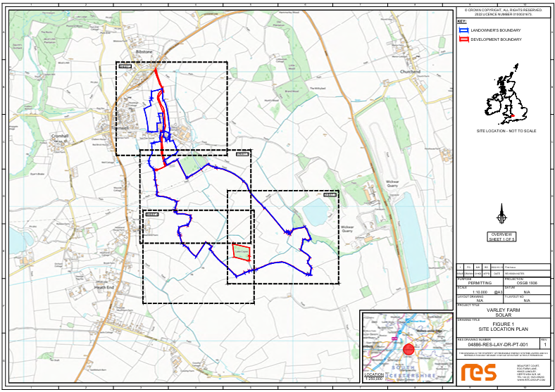
- Figure 1 - Site Location Plan
- Figure 2 - Site Location Map
- Figure 3 - Field Numbers
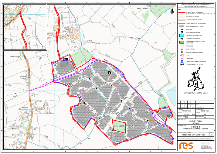
- Figure 4 - Infrastructure Layout
- Figure 5 - Infrastructure Layout Enlargements
- Figure 6 - Internal Access Road Typical Detail
- Figure 7 - Typical Temporary Construction Compound Layout
- Figure 8 - Typical PV Module and Rack Detail
- Figure 9 - Typical Substation Fence Details
- Figure 10 - Perimeter Fence Deer Fence and Typical Details
- Figure 11 - Typical Inverter Substation
- Figure 12 - Client/DNO Substation
- Figure 13 - Typical CCTV Details
- Figure 14 - Gas Pipe Protection Slab
Agricultural Land Classification
Arboricultural Impact Assessment
Construction Traffic Management Plan
Flood Risk Assessment and Surface Water Drainage Strategy
Heritage Desk-Based Assessment
Landscape and Ecological Management Plan
Landscape and Visual Impact Assessment (LVIA)
- LVIA Appendices
- LVIA Figure 1: Site Location and Context Plan
- LVIA Figure 2: Landscape Strategy Plan
- LVIA Figure 3 :Topography and Visual Receptors Plan
- LVIA Figure 4: Screened Zone of Theoretical Visibility and Viewpoint Locations Plan
- LVIA Figure 5: Context Baseline Viewpoints and Photoviews
- LVIA Figure 6: Photomontages and Wirelines
Site location
Click to enlarge
Proposed development
Click to enlarge
Additional Information I
In May 2023, RES submitted additional information in relation to the Varley Solar Farm application. The additional information relates to Landscape and Visual Impact, Built Heritage, Flood Risk and Drainage, Designing Out Crime, Biodiversity and Response to Public Comments. The additional information can be viewed by clicking on the links below.
Additional Information II
Additional Information II
In September 2023, RES submitted additional information in relation to the Varley Solar Farm application. The additional information relates to the removal of solar infrastructure adjacent to the Public Right of Way to the east of the site, additional planting for screening resulting in an increased Biodiversity Net Gain and further information on Flood Risk and Drainage. The additional information can be viewed by clicking on the links below.